


day

FSantoni
User
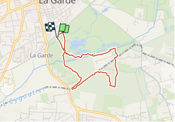

Length
3.7 km

Max alt
26 m

Uphill gradient
20 m
Km-Effort
4 km

Min alt
20 m

Downhill gradient
22 m
Boucle
Yes
Creation date :
2023-10-02 13:08:59.824
Updated on :
2023-10-02 14:19:37.726
1h10
Difficulty : Easy

FREE GPS app for hiking
 SityTrail
IGN / Geographical institutes
SityTrail Plus
The world is yours!
About
Trail Walking of 3.7 km to be discovered at Provence-Alpes-Côte d'Azur, Var, La Garde. This trail is proposed by FSantoni.
Positioning
Country:
France
Region :
Provence-Alpes-Côte d'Azur
Department/Province :
Var
Municipality :
La Garde
Location:
Unknown
Start:(Dec)
Start:(UTM)
257004 ; 4778456 (32T) N.
Comments